

Route Guide - Leslie Gulch
Succor Creek and Leslie Gulch are so beautiful you will be amazed they’re just barely over the Oregon border. First ridden by IWBP in April 2024.

Overview
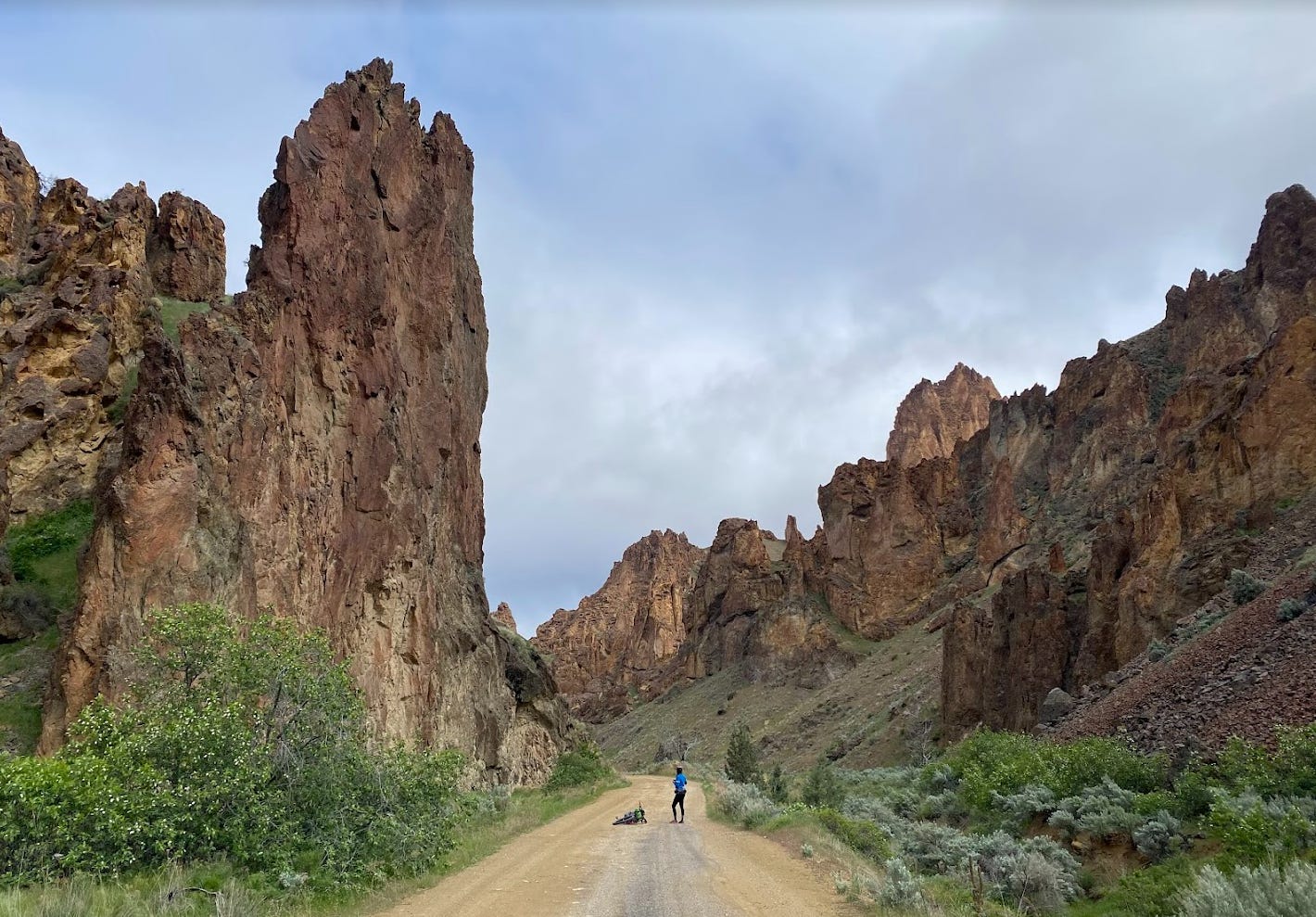
The strikingly jagged multicolored cliffs of Succor Creek State Natural Area and Leslie Gulch tower over this route for miles. We’re convinced traveling by bike is the best way to truly see and enjoy them. And if you have time, take side hikes into Juniper Gulch or Dago Gulch. With any luck, you may see deer, elk, coyotes, or even California bighorn sheep (reintroduced to the area in 1965).
Total Route: 74 miles with 7200 feet of climbing. As a out-and-back, it would be easy to do more or less by varying the staring point.
Terrain: 100% gravel, 0% pavement, 0% singletrack.
Suggested Starting Point: Park at and start from a gravel pullout off of Succor Creek Road. Coordinates: 43.61082, -117.09375; Google Maps.
Difficulty *
Climbing scale 5/10 (88 feet per mile). Moderate climbs both days. Approximate total climbing day one 3600 feet and day two 3600 feet.
Technical scale 2/10. The descent into Leslie Gulch is long and some gravel may be lose. Otherwise there are no technical sections (unless there is snow / ice / mud on the road).
Physical demand 4/10. Riders should be in decent shape, having done at least a few longer rides in the preceding month.
Resupply and Logistics 4/10. No facilities, running water, or food resupply. Up to 25 mile stretches without water (depending on the time of year — see water below). Four full meals will need to be carried for a basic two-day pace.
Day 1
Ride south through the beautiful Succor Creek State Natural Area before a long gradual climb toward Smith Butte. Then enjoy a long nine-mile descent down Leslie Gulch, lined the whole way with spectacular rock cliffs and spires, until reaching the Owyhee Reservoir at mile 37.
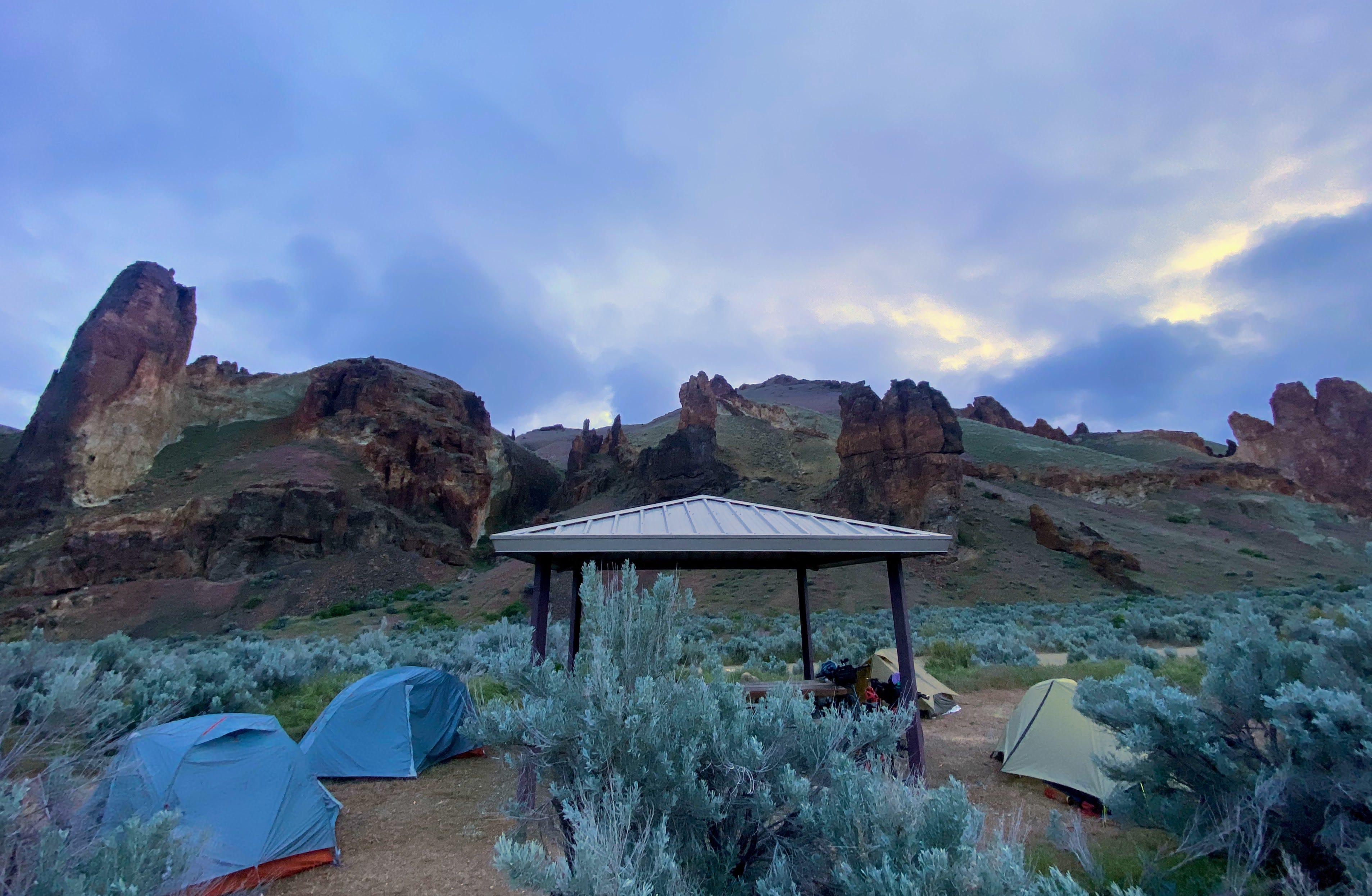
Suggested Campsite
Slocum Creek Campground is about a quarter mile from the lakeshore. GPS coordinates 43.321297, -117.319000. The campground has pit toilets and 10 sites, each with a table, sun shelter, and fire pit. No electricity or water. First-come-first served, no reservations or fees.
Day 2
Return along the same route. Enjoy the long ascent back up Leslie Gulch, taking in the sights at a slower pace and with different light.
Food and Resupply
There is no food resupply on this route. A suggested two-day food plan would be day 1, breakfast before starting, trailside lunch (no cooking required), and dinner to prep / cook at camp. Day 2, breakfast at camp, and a trailside lunch. Always include plenty of snacks.
Water
Bring around 2-4 liters carrying capacity, depending on weather and time of year. There is no potable water. Year round water for filtering can be found at Succor Creek (mile 10 and 65) and the reservoir (mile 37). In the spring, there will be multiple smaller streams running between those two points. The campsite is a short walk from the lakeshore.

Route Links
Misc.
Our recommended ideal time of year for this ride is April to May.
The roads in this area do not hold up well to heavy rain, and will turn into unrideable sticky clay when saturated.
Cell service will not be available for most or all of this route.
Bikepacking can be strenuous and dangerous. You ride at your own risk.
Please practice the Leave No Trace Seven Principles.
* Difficulty ratings are modeled after bikepacking.com's system. Ratings are somewhat subjective, and can change based on weather, individual fitness and abilities, and other environmental factors. We welcome input on ratings.
Hi! Some girlfriends and I are considering doing this route this spring - thank you so much for the write up! Quick questions on gear - it looks like you rode mountain bikes, would you recommend having wider tires for this ride? We were considering taking our gravel bikes. Also, did you run into any issues with goat heads? Other write ups for the area mention them quite a bit, so curious if they gave you any trouble.